vessel Maran Gas Lindos IMO: 9627502, Lng Tanker
vesseltracker.com
Vessel Maran Gas Lindos IMO: 9627502, Lng Tanker
MMSI: 241351000 callsign: SVCB7 size: 294x44

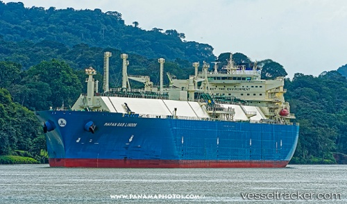
Find the position of the vessel Maran Gas Lindos on the map. The latter are known coordinates and path.

marine traffic ship tracker show on live map

The current position of vessel Maran Gas Lindos is 1.17033 lat / 103.713 lng. Updated: 2025-09-03 18:50:45 UTC

Currently sailing under the flag of Greece

Details:


Last coordinates of the vessel:
UTC, 1.1694, 103.712, course: 303, speed: 0
UTC, 1.1701, 103.713, course: 280, speed: 0.3
UTC, 1.17051, 103.713, course: 264, speed: 0.1
2025-09-03 18:50:45 UTC, 1.17033, 103.713, course: 271, speed: 0.1

Track of the vessel in the last 14 days


The ship also appears on the maps:


Most frequent ports a vessels calls at Maran Gas Lindos (241351000):

Sambu, traffic: 16
Singapore, traffic: 11
RAS LAFFAN, traffic: 7
BUKOM ISLAND, traffic: 5
TANAH MERAH, traffic: 4
JURONG ISLAND, traffic: 3
DHAMRA, traffic: 3
Selat Wetar, traffic: 3
PULAU SAMBU, traffic: 3
Gladstone Harbor, traffic: 3
Torres Strait, traffic: 2
Yokkaichi, traffic: 2
PENGERANG, traffic: 2
Zeebrugge, traffic: 2
Bur Ibrahim, traffic: 2

Link to the map:


Find another ship

Maran_Gas_Lindos (241351000) last ports (portcalls and passsages)

BUKOM ISLAND | 2025-09-03 08:46:59
TANAH MERAH | 2025-08-29 07:25:48
Sambu | 2025-08-29 06:47:01
BUKOM ISLAND | 2025-08-27 17:06:09
Assaluyeh | 2025-08-16 21:15:40
RAS LAFFAN | 2025-08-15 22:50:32
BUKOM ISLAND | 2025-07-24 18:06:01
RAS LAFFAN | 2025-07-02 05:08:32
ASALUYEH | 2025-07-01 21:09:46
Assaluyeh | 2025-07-01 17:54:15
DHAMRA | 2025-06-20 20:02:21
RAS LAFFAN | 2025-06-06 10:20:32
BUKOM ISLAND | 2025-05-27 04:00:41
TANAH MERAH | 2025-05-27 02:48:33
PENGERANG | 2025-05-27 02:11:22
PENGERANG | 2025-05-11 17:30:32
TANAH MERAH | 2025-05-11 17:14:41
RAS LAFFAN | 2025-05-01 13:27:01
RAS LAFFAN | 2025-04-01 06:35:34
DHAMRA | 2025-03-19 01:41:22
RAS LAFFAN | 2025-03-06 08:28:32
DHAMRA | 2025-02-19 01:58:28
Das Island | 2025-02-08 19:35:17
Sambu | 2025-01-26 06:30:46
TANAH MERAH | 2025-01-26 05:24:57
ZHOUSHAN | 2025-01-17 05:04:05
Sambu | 2025-01-07 20:41:11
RAS LAFFAN | 2024-12-28 08:26:04
BUKOM ISLAND | 2024-12-13 18:06:35
JURONG ISLAND | 2024-12-13 17:14:52
Sint Nicolaashaven | 2024-11-15 22:31:24
Oranjestad | 2024-11-15 20:10:10
SABINE PASS | 2024-11-07 19:58:07
Singapore | 2024-06-28 05:02:38
Map Ta Phut | 2024-06-24 23:05:42
Singapore | 2024-05-26 20:05:14
Zeebrugge | 2024-01-22 19:03:52
Aliaga | 2023-12-11 18:13:09
Nemrut Bay | 2023-12-11 15:18:05
Kalamai | 2023-12-07 05:26:36
Strait Of Gibraltar | 2023-12-04 01:24:19
Donges | 2023-11-11 13:35:46
Zeebrugge | 2023-10-18 06:21:29
Dampier | 2023-02-23 08:28:38
Sambu | 2022-11-21 02:15:31
Ra’S Shukhayr | 2022-10-20 01:39:57
Bur Ibrahim | 2022-10-19 17:02:32
Port Said | 2022-10-19 04:09:38
Milford Haven | 2022-10-08 10:15:43
Bur Ibrahim | 2022-09-29 04:13:39
Mutrah | 2022-08-24 07:45:25
Selat Wetar | 2022-06-04 07:30:03
Kawasaki | 2022-05-24 01:55:44
Yokosuka | 2022-05-22 22:47:37
Gladstone Harbor | 2022-03-04 06:00:21
Torres Strait | 2022-02-28 07:57:55
Yokkaichi | 2022-01-26 01:45:02
Gladstone Harbor | 2022-01-12 12:15:29
Sambu | 2021-12-23 20:05:38
Sambu | 2021-12-23 19:40:19
Sambu | 2021-12-23 19:35:10
Singapore | 2021-12-21 07:50:11
Sambu | 2021-12-21 07:10:09
Sambu | 2021-12-21 06:55:41
Selat Wetar | 2021-12-05 20:18:18