 vesseltracker.com
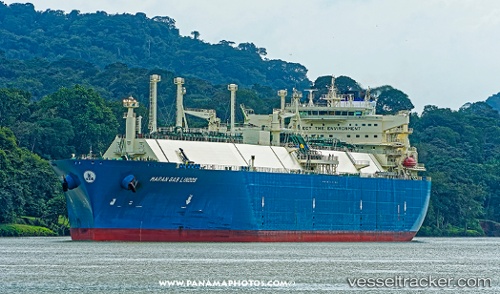
Vessel Maran Gas Lindos IMO: 9627502, MMSI: 241351000 Lng Tanker
UTC, 19.51103, 127.61709, course: 157, speed: 9.1
UTC, 19.51103, 127.61709, course: 157, speed: 9.1
2026-03-01 12:43:45 UTC, 19.51103, 127.61709, course: 157, speed: 9.1
Live AIS position:
UTC. 321 nm E of Port Irene),
updated 2026-03-01 12:43:45 UTC.
Find the position of the vessel Maran Gas Lindos on the map. The latter are known coordinates and path.
marine traffic ship tracker show on live map
The current position of vessel Maran Gas Lindos is 19.51103 lat / 127.61709 lng. Updated: 2026-03-01 12:43:45 UTCCurrently sailing under the flag of Greece
Details:
Last coordinates of the vessel:
UTC, 20.14607, 127.48541, course: 164, speed: 10.6UTC, 19.51103, 127.61709, course: 157, speed: 9.1
UTC, 19.51103, 127.61709, course: 157, speed: 9.1
2026-03-01 12:43:45 UTC, 19.51103, 127.61709, course: 157, speed: 9.1