 vesseltracker.com
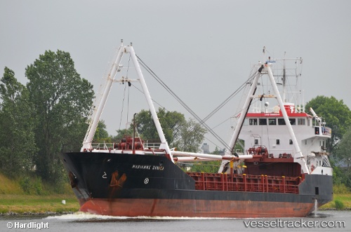
Vessel Marianne Danica IMO: 9006241, MMSI: 219544000 General Cargo Ship
UTC, 32.66333, -75.62833, course: -1, speed: 9
UTC, 32.81500, -76.02833, course: -1, speed: 9
2026-03-06 21:38:07 UTC, 32.89500, -76.22333, course: -1, speed: 9
Live Vessel Marianne Danica Analytics (details, animations, etc.)
Live AIS position: UTC. 58 nm NE of Port Royal), updated 2026-03-06 21:38:07 UTC.Find the position of the vessel Marianne Danica on the map. The latter are known coordinates and path.
marine traffic ship tracker show on live map
The current position of vessel Marianne Danica is 32.89500 lat / -76.22333 lng. Updated: 2026-03-06 21:38:07 UTCDetails:
Last coordinates of the vessel:
UTC, 32.55500, -75.21333, course: -1, speed: 9UTC, 32.66333, -75.62833, course: -1, speed: 9
UTC, 32.81500, -76.02833, course: -1, speed: 9
2026-03-06 21:38:07 UTC, 32.89500, -76.22333, course: -1, speed: 9