 vesseltracker.com
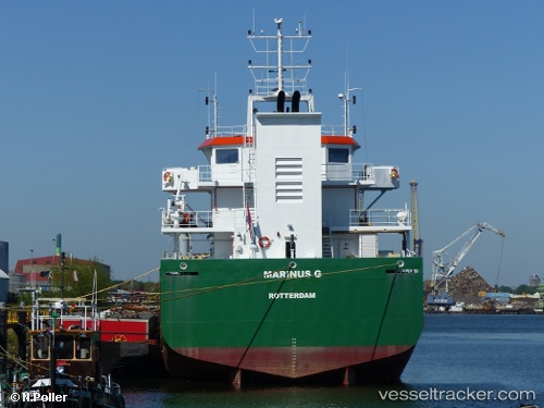
Vessel Marinus G IMO: 9566318, MMSI: 244130717 Hopper Dredger
UTC, 53.39607, 6.95198, course: -1, speed: 2
UTC, 53.39711, 6.95148, course: -1, speed: 1.5
2026-03-04 19:30:41 UTC, 53.40109, 6.94881, course: -1, speed: 4.1
Live Vessel Marinus G Analytics (details, animations, etc.)
Live AIS position: UTC. Near Bierum), updated 2026-03-04 19:30:41 UTC.Find the position of the vessel Marinus G on the map. The latter are known coordinates and path.
marine traffic ship tracker show on live map
The current position of vessel Marinus G is 53.40109 lat / 6.94881 lng. Updated: 2026-03-04 19:30:41 UTCCurrently sailing under the flag of Netherlands
Marinus G built in 2010 year
Deadweight:
4300 tDetails:
Last coordinates of the vessel:
UTC, 53.33277, 6.93328, course: -1, speed: 0UTC, 53.39607, 6.95198, course: -1, speed: 2
UTC, 53.39711, 6.95148, course: -1, speed: 1.5
2026-03-04 19:30:41 UTC, 53.40109, 6.94881, course: -1, speed: 4.1