 vesseltracker.com
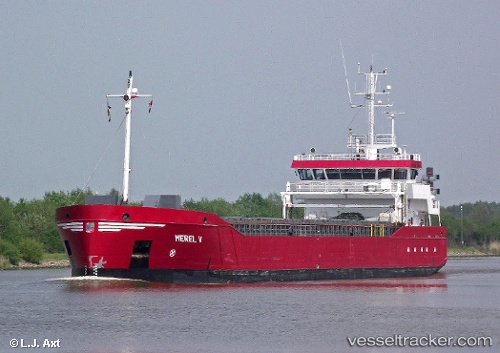
Vessel Merel V IMO: 9279056, MMSI: 246395000 General Cargo Ship
UTC, 53.47306, 6.83566, course: 349, speed: 8.1
UTC, 53.68843, 6.55579, course: 60, speed: 9.4
2026-02-28 12:23:49 UTC, 53.84456, 7.23630, course: 72, speed: 9.1
Live AIS position:
UTC. Near Baltrum),
updated 2026-02-28 12:23:49 UTC.
Find the position of the vessel Merel V on the map. The latter are known coordinates and path.
marine traffic ship tracker show on live map
The current position of vessel Merel V is 53.84456 lat / 7.23630 lng. Updated: 2026-02-28 12:23:49 UTCCurrently sailing under the flag of Netherlands
Merel V built in 2005 year
Deadweight:
3200 tDetails:
Last coordinates of the vessel:
UTC, 53.45016, 6.81710, course: 284, speed: 0UTC, 53.47306, 6.83566, course: 349, speed: 8.1
UTC, 53.68843, 6.55579, course: 60, speed: 9.4
2026-02-28 12:23:49 UTC, 53.84456, 7.23630, course: 72, speed: 9.1