 vesseltracker.com
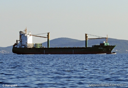
Vessel Msc Claudia IMO: 9113446, MMSI: 636018573 Container Ship
UTC, 24.77167, -16.96333, course: -1, speed: 11
UTC, 25.11720, -16.72668, course: -1, speed: 12.2
2026-03-01 15:54:32 UTC, 25.38303, -16.50710, course: -1, speed: 13
Live AIS position:
UTC. 106 nm N of Ad Dakhla),
updated 2026-03-01 15:54:32 UTC.
Find the position of the vessel Msc Claudia on the map. The latter are known coordinates and path.
marine traffic ship tracker show on live map
The current position of vessel Msc Claudia is 25.38303 lat / -16.50710 lng. Updated: 2026-03-01 15:54:32 UTCCurrently sailing under the flag of Liberia
Msc Claudia built in 1996 year
Deadweight:
18335 tDetails:
Last coordinates of the vessel:
UTC, 24.40333, -17.11500, course: -1, speed: 11UTC, 24.77167, -16.96333, course: -1, speed: 11
UTC, 25.11720, -16.72668, course: -1, speed: 12.2
2026-03-01 15:54:32 UTC, 25.38303, -16.50710, course: -1, speed: 13