 vesseltracker.com
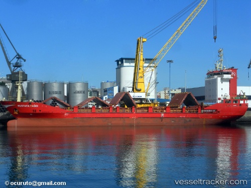
Vessel Mustafa Yagci IMO: 9314545, MMSI: 271000862 Deck Cargo Ship
UTC, 33.45646, 17.72814, course: 64, speed: 11.3
UTC, 33.62319, 18.12214, course: 67, speed: 11.4
2026-02-22 04:42:21 UTC, 33.77991, 18.55762, course: 66, speed: 10.9
Live AIS position:
UTC. Near Pinelands),
updated 2026-02-22 04:42:21 UTC.
Find the position of the vessel Mustafa Yagci on the map. The latter are known coordinates and path.
marine traffic ship tracker show on live map
The current position of vessel Mustafa Yagci is 33.77991 lat / 18.55762 lng. Updated: 2026-02-22 04:42:21 UTCCurrently sailing under the flag of Turkey
Mustafa Yagci built in 2006 year
Deadweight:
5567 tDetails:
Last coordinates of the vessel:
UTC, 33.41768, 17.64003, course: 63, speed: 11.9UTC, 33.45646, 17.72814, course: 64, speed: 11.3
UTC, 33.62319, 18.12214, course: 67, speed: 11.4
2026-02-22 04:42:21 UTC, 33.77991, 18.55762, course: 66, speed: 10.9