 vesseltracker.com
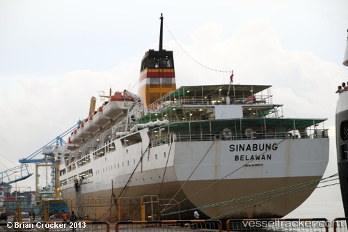
Vessel Mv. Sinabung IMO: 9139672, MMSI: 525005031 Passenger Ship
UTC, -0.86780, 131.06535, course: 90, speed: 15
UTC, -0.87820, 131.24579, course: 288, speed: 0
2026-02-21 21:49:34 UTC, -0.87822, 131.24577, course: 288, speed: 0
Live AIS position:
UTC. Near Sorong),
updated 2026-02-21 21:49:34 UTC.
Find the position of the vessel Mv. Sinabung on the map. The latter are known coordinates and path.
marine traffic ship tracker show on live map
The current position of vessel Mv. Sinabung is -0.87822 lat / 131.24577 lng. Updated: 2026-02-21 21:49:34 UTCCurrently sailing under the flag of Indonesia
Mv. Sinabung built in 1997 year
Deadweight:
3485 tDetails:
Last coordinates of the vessel:
UTC, -0.93124, 130.61610, course: 75, speed: 13.8UTC, -0.86780, 131.06535, course: 90, speed: 15
UTC, -0.87820, 131.24579, course: 288, speed: 0
2026-02-21 21:49:34 UTC, -0.87822, 131.24577, course: 288, speed: 0