 vesseltracker.com
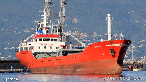
Vessel Naciye K IMO: 9217577, MMSI: 374331000 General Cargo Ship
UTC, 41.64715, 41.64843, course: 84, speed: 0.1
UTC, 41.70271, 41.57950, course: 269, speed: 7.3
2026-02-09 17:42:12 UTC, 41.63884, 41.37481, course: 226, speed: 9.1
Live AIS position:
UTC. 12 nm W of Batumi),
updated 2026-02-09 17:42:12 UTC.
Find the position of the vessel Naciye K on the map. The latter are known coordinates and path.
marine traffic ship tracker show on live map
The current position of vessel Naciye K is 41.63884 lat / 41.37481 lng. Updated: 2026-02-09 17:42:12 UTCCurrently sailing under the flag of Panama
Naciye K built in 2000 year
Deadweight:
2340 tDetails:
Last coordinates of the vessel:
UTC, 41.64714, 41.64842, course: 84, speed: 0.1UTC, 41.64715, 41.64843, course: 84, speed: 0.1
UTC, 41.70271, 41.57950, course: 269, speed: 7.3
2026-02-09 17:42:12 UTC, 41.63884, 41.37481, course: 226, speed: 9.1