 vesseltracker.com
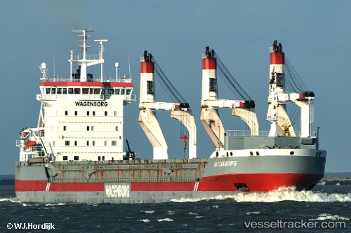
Vessel Nassauborg IMO: 9248564, MMSI: 246430000 General Cargo Ship
UTC, 36.31939, 14.44971, course: 112, speed: 11.9
UTC, 36.22619, 14.74471, course: 107, speed: 12
2026-02-13 13:53:04 UTC, 36.04500, 15.28333, course: -1, speed: 12
Live AIS position:
UTC. 14 nm SW of Villafranca Tirrena),
updated 2026-02-13 13:53:04 UTC.
Find the position of the vessel Nassauborg on the map. The latter are known coordinates and path.
marine traffic ship tracker show on live map
The current position of vessel Nassauborg is 36.04500 lat / 15.28333 lng. Updated: 2026-02-13 13:53:04 UTCCurrently sailing under the flag of Netherlands
Nassauborg built in 2006 year
Deadweight:
16615 tDetails:
Last coordinates of the vessel:
UTC, 36.52222, 13.80662, course: 110, speed: 11.8UTC, 36.31939, 14.44971, course: 112, speed: 11.9
UTC, 36.22619, 14.74471, course: 107, speed: 12
2026-02-13 13:53:04 UTC, 36.04500, 15.28333, course: -1, speed: 12