 vesseltracker.com
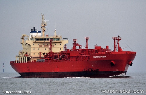
Vessel Navigator Libra IMO: 9482586, MMSI: 636015188 Lpg Tanker
UTC, 25.02828, -95.27644, course: 37, speed: 10.9
UTC, 25.41167, -94.95333, course: -1, speed: 11
2026-02-15 03:26:27 UTC, 25.53500, -94.81333, course: -1, speed: 11
Live AIS position:
UTC. 131 nm E of South Padre Island),
updated 2026-02-15 03:26:27 UTC.
Find the position of the vessel Navigator Libra on the map. The latter are known coordinates and path.
marine traffic ship tracker show on live map
The current position of vessel Navigator Libra is 25.53500 lat / -94.81333 lng. Updated: 2026-02-15 03:26:27 UTCCurrently sailing under the flag of Liberia
Navigator Libra built in 2012 year
Deadweight:
22911 tDetails:
Last coordinates of the vessel:
UTC, 24.69833, -95.58667, course: -1, speed: 11UTC, 25.02828, -95.27644, course: 37, speed: 10.9
UTC, 25.41167, -94.95333, course: -1, speed: 11
2026-02-15 03:26:27 UTC, 25.53500, -94.81333, course: -1, speed: 11