 vesseltracker.com
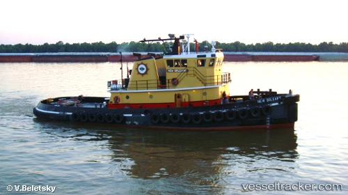
Vessel New Orleans IMO: 8964630, MMSI: 366983080 Tug
UTC, 30.04607, -90.54023, course: -1, speed: 10.3
UTC, 29.99210, -90.43710, course: -1, speed: 0
2026-02-15 03:27:12 UTC, 29.99207, -90.43712, course: -1, speed: 0
Live AIS position:
UTC. Near Good Hope),
updated 2026-02-15 03:27:12 UTC.
Find the position of the vessel New Orleans on the map. The latter are known coordinates and path.
marine traffic ship tracker show on live map
The current position of vessel New Orleans is 29.99207 lat / -90.43712 lng. Updated: 2026-02-15 03:27:12 UTCCurrently sailing under the flag of USA
New Orleans built in 1998 year
Details:
Last coordinates of the vessel:
UTC, 30.05423, -90.57677, course: -1, speed: 0.1UTC, 30.04607, -90.54023, course: -1, speed: 10.3
UTC, 29.99210, -90.43710, course: -1, speed: 0
2026-02-15 03:27:12 UTC, 29.99207, -90.43712, course: -1, speed: 0