 vesseltracker.com
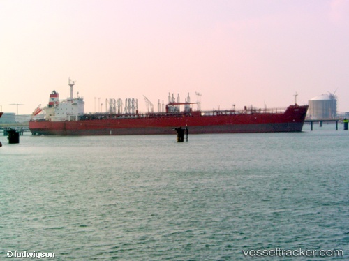
Vessel Ohio IMO: 9417440, MMSI: 311013400 Crude Oil Tanker
UTC, 38.38508, 19.88538, course: 161, speed: 11
UTC, 38.18850, 19.99292, course: 154, speed: 10.8
2026-02-18 04:08:23 UTC, 38.09342, 20.05687, course: 152, speed: 10.7
Live AIS position:
UTC. 18 nm SW of Petani Beach),
updated 2026-02-18 04:08:23 UTC.
Find the position of the vessel Ohio on the map. The latter are known coordinates and path.
marine traffic ship tracker show on live map
The current position of vessel Ohio is 38.09342 lat / 20.05687 lng. Updated: 2026-02-18 04:08:23 UTCCurrently sailing under the flag of Bahamas
Ohio built in 2009 year
Deadweight:
105188 tDetails:
Last coordinates of the vessel:
UTC, 39.14238, 19.50228, course: 162, speed: 10.3UTC, 38.38508, 19.88538, course: 161, speed: 11
UTC, 38.18850, 19.99292, course: 154, speed: 10.8
2026-02-18 04:08:23 UTC, 38.09342, 20.05687, course: 152, speed: 10.7