 vesseltracker.com
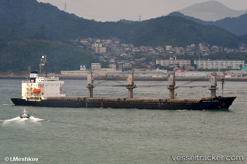
Vessel PRINCESS MANISSA IMO: 9084217, MMSI: 341260000 Bulk Carrier
UTC, 38.62014, -10.08206, course: 167, speed: 9.8
UTC, 38.30523, -9.99621, course: 198, speed: 5.7
2026-02-07 11:35:21 UTC, 38.13772, -9.99728, course: 173, speed: 7.6
Live AIS position:
UTC. 19 nm NE of Los Ramos),
updated 2026-02-07 11:35:21 UTC.
Find the position of the vessel PRINCESS MANISSA on the map. The latter are known coordinates and path.
marine traffic ship tracker show on live map
The current position of vessel PRINCESS MANISSA is 38.13772 lat / -9.99728 lng. Updated: 2026-02-07 11:35:21 UTCCurrently sailing under the flag of St Kitts Nevis
PRINCESS MANISSA built in 1994 year
Deadweight:
22020 tDetails:
Last coordinates of the vessel:
UTC, 38.88240, -10.10329, course: 186, speed: 9.5UTC, 38.62014, -10.08206, course: 167, speed: 9.8
UTC, 38.30523, -9.99621, course: 198, speed: 5.7
2026-02-07 11:35:21 UTC, 38.13772, -9.99728, course: 173, speed: 7.6