 vesseltracker.com
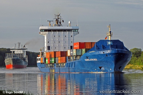
Vessel NJORD IMO: 9349227, MMSI: 245872000 Container Ship
UTC, 36.48333, 16.88500, course: -1, speed: 15
UTC, 36.48333, 16.88500, course: -1, speed: 15
2026-02-21 07:40:49 UTC, 36.41989, 19.52669, course: 92, speed: 15.6
Live AIS position:
UTC. 105 nm SW of VASILIKO),
updated 2026-02-21 07:40:49 UTC.
Find the position of the vessel NJORD on the map. The latter are known coordinates and path.
marine traffic ship tracker show on live map
The current position of vessel NJORD is 36.41989 lat / 19.52669 lng. Updated: 2026-02-21 07:40:49 UTCCurrently sailing under the flag of Netherlands
NJORD built in 2007 year
Deadweight:
9543 tDetails:
Last coordinates of the vessel:
UTC, 36.48333, 16.88500, course: -1, speed: 15UTC, 36.48333, 16.88500, course: -1, speed: 15
UTC, 36.48333, 16.88500, course: -1, speed: 15
2026-02-21 07:40:49 UTC, 36.41989, 19.52669, course: 92, speed: 15.6