 vesseltracker.com
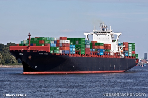
Vessel TIMON IMO: 9415844, MMSI: 636021306 Container Ship
UTC, 2.76795, 101.29718, course: 47, speed: 0
UTC, 2.76858, 101.29678, course: 66, speed: 0.1
2026-01-25 17:54:43 UTC, 2.76994, 101.29667, course: 108, speed: 0
Live AIS position:
UTC. Near Pulau Indah),
updated 2026-01-25 17:54:43 UTC.
Find the position of the vessel TIMON on the map. The latter are known coordinates and path.
marine traffic ship tracker show on live map
The current position of vessel TIMON is 2.76994 lat / 101.29667 lng. Updated: 2026-01-25 17:54:43 UTCCurrently sailing under the flag of Liberia
TIMON built in 2009 year
Deadweight:
85622 tDetails:
Last coordinates of the vessel:
UTC, 2.77048, 101.29693, course: 125, speed: 0.1UTC, 2.76795, 101.29718, course: 47, speed: 0
UTC, 2.76858, 101.29678, course: 66, speed: 0.1
2026-01-25 17:54:43 UTC, 2.76994, 101.29667, course: 108, speed: 0