 vesseltracker.com
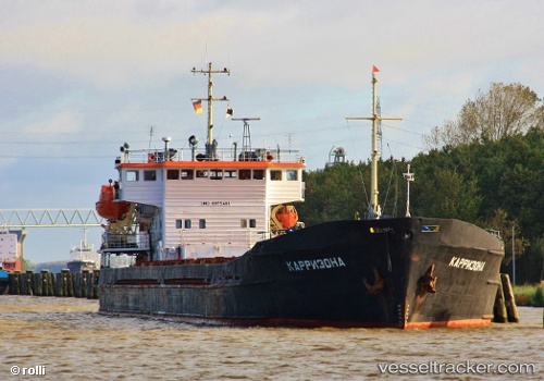
Vessel Taganrog IMO: 8955469, MMSI: 273350080 Multi Purpose Carrier
UTC, 45.49500, 36.54833, course: -1, speed: 0
UTC, 45.49500, 36.54833, course: -1, speed: 0
2026-03-02 14:30:59 UTC, 45.49500, 36.54833, course: -1, speed: 0
Live AIS position:
UTC. Near Kerch),
updated 2026-03-02 14:30:59 UTC.
Find the position of the vessel Taganrog on the map. The latter are known coordinates and path.
marine traffic ship tracker show on live map
The current position of vessel Taganrog is 45.49500 lat / 36.54833 lng. Updated: 2026-03-02 14:30:59 UTCDetails:
Last coordinates of the vessel:
UTC, 46.35333, 37.15500, course: -1, speed: 8UTC, 45.49500, 36.54833, course: -1, speed: 0
UTC, 45.49500, 36.54833, course: -1, speed: 0
2026-03-02 14:30:59 UTC, 45.49500, 36.54833, course: -1, speed: 0