 vesseltracker.com
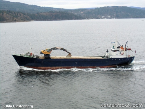
Vessel Torvaag IMO: 6904935, MMSI: 258446000 General Cargo Ship
UTC, 65.46289, 12.19129, course: 205, speed: 0
2026-01-22 11:29:32 UTC, 65.46291, 12.19129, course: 206, speed: 0
Live AIS position:
UTC. Near Brønnøysund),
updated 2026-01-22 11:29:32 UTC.
Find the position of the vessel Torvaag on the map. The latter are known coordinates and path.
marine traffic ship tracker show on live map
The current position of vessel Torvaag is 65.46291 lat / 12.19129 lng. Updated: 2026-01-22 11:29:32 UTCCurrently sailing under the flag of Norway
Torvaag built in 1968 year
Deadweight:
673 tDetails:
Last coordinates of the vessel:
UTC, 65.46283, 12.19125, course: 204, speed: 0UTC, 65.46289, 12.19129, course: 205, speed: 0
2026-01-22 11:29:32 UTC, 65.46291, 12.19129, course: 206, speed: 0