 vesseltracker.com
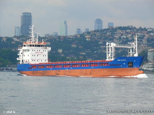
Vessel Turk Yildizi 2 IMO: 9703021, MMSI: 271043811 General Cargo Ship
UTC, 42.03345, 34.21810, course: 272, speed: 9.3
UTC, 42.04878, 33.78889, course: 273, speed: 9.8
2026-02-08 10:29:37 UTC, 42.08776, 33.18508, course: 274, speed: 9.4
Live AIS position:
UTC. 14 nm NE of Cide),
updated 2026-02-08 10:29:37 UTC.
Find the position of the vessel Turk Yildizi 2 on the map. The latter are known coordinates and path.
marine traffic ship tracker show on live map
The current position of vessel Turk Yildizi 2 is 42.08776 lat / 33.18508 lng. Updated: 2026-02-08 10:29:37 UTCCurrently sailing under the flag of Turkey
Details:
Last coordinates of the vessel:
UTC, 42.03468, 34.53978, course: 269, speed: 8.8UTC, 42.03345, 34.21810, course: 272, speed: 9.3
UTC, 42.04878, 33.78889, course: 273, speed: 9.8
2026-02-08 10:29:37 UTC, 42.08776, 33.18508, course: 274, speed: 9.4