 vesseltracker.com
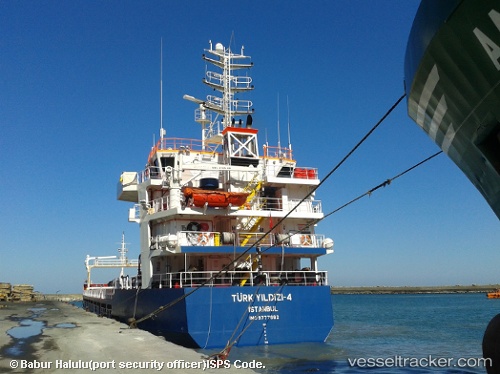
Vessel Turk Yildizi 4 IMO: 9777682, MMSI: 271044443 Bulk Carrier
UTC, 40.96466, 28.67778, course: 178, speed: 0
UTC, 40.96467, 28.67777, course: 178, speed: 0
2026-02-09 03:30:12 UTC, 40.96467, 28.67776, course: 178, speed: 0
Live AIS position:
UTC. Near Ambarli),
updated 2026-02-09 03:30:12 UTC.
Find the position of the vessel Turk Yildizi 4 on the map. The latter are known coordinates and path.
marine traffic ship tracker show on live map
The current position of vessel Turk Yildizi 4 is 40.96467 lat / 28.67776 lng. Updated: 2026-02-09 03:30:12 UTCCurrently sailing under the flag of Turkey
Details:
Last coordinates of the vessel:
UTC, 40.96466, 28.67777, course: 177, speed: 0UTC, 40.96466, 28.67778, course: 178, speed: 0
UTC, 40.96467, 28.67777, course: 178, speed: 0
2026-02-09 03:30:12 UTC, 40.96467, 28.67776, course: 178, speed: 0