 vesseltracker.com
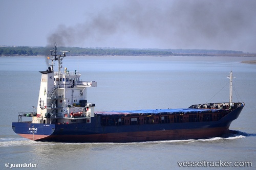
Vessel UNIWIND IMO: 8919790, MMSI: 341288000 General Cargo Ship
UTC, 31.14221, 29.80252, course: 212, speed: 0.2
UTC, 31.14219, 29.80251, course: 212, speed: 0
2026-02-14 01:57:31 UTC, 31.14219, 29.80251, course: 212, speed: 0.1
Live AIS position:
UTC. Near EL DEKHEILA),
updated 2026-02-14 01:57:31 UTC.
Find the position of the vessel UNIWIND on the map. The latter are known coordinates and path.
marine traffic ship tracker show on live map
The current position of vessel UNIWIND is 31.14219 lat / 29.80251 lng. Updated: 2026-02-14 01:57:31 UTCCurrently sailing under the flag of St.Kitts and Nevis
UNIWIND built in 1990 year
Deadweight:
3000 tDetails:
Last coordinates of the vessel:
UTC, 31.14223, 29.80250, course: 212, speed: 0.1UTC, 31.14221, 29.80252, course: 212, speed: 0.2
UTC, 31.14219, 29.80251, course: 212, speed: 0
2026-02-14 01:57:31 UTC, 31.14219, 29.80251, course: 212, speed: 0.1