 vesseltracker.com
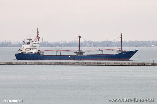
Vessel UMIT G IMO: 9041124, MMSI: 352001539 General Cargo Ship
UTC, 44.49192, 29.83859, course: 11, speed: 7.4
UTC, 44.49192, 29.83859, course: 11, speed: 7.4
2026-02-28 18:43:10 UTC, 44.49192, 29.83859, course: 11, speed: 7.4
Live Vessel UMIT G Analytics (details, animations, etc.)
Live AIS position: UTC. 40 nm S of Sulina (Port et Zone Franche)), updated 2026-02-28 18:43:10 UTC.Find the position of the vessel UMIT G on the map. The latter are known coordinates and path.
marine traffic ship tracker show on live map
The current position of vessel UMIT G is 44.49192 lat / 29.83859 lng. Updated: 2026-02-28 18:43:10 UTCCurrently sailing under the flag of Panama
UMIT G built in 1991 year
Deadweight:
4495 tDetails:
Last coordinates of the vessel:
UTC, 44.33195, 29.78832, course: 12, speed: 7.4UTC, 44.49192, 29.83859, course: 11, speed: 7.4
UTC, 44.49192, 29.83859, course: 11, speed: 7.4
2026-02-28 18:43:10 UTC, 44.49192, 29.83859, course: 11, speed: 7.4