 vesseltracker.com
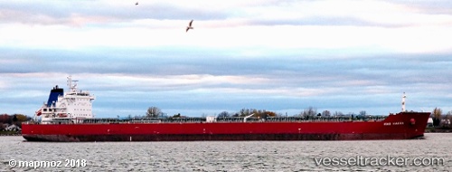
Vessel Unity N IMO: 9490466, MMSI: 538006451 Bulk Carrier
UTC, 46.99033, -31.86917, course: 252, speed: 8
UTC, 46.93333, -32.25167, course: -1, speed: 7
2026-02-14 01:49:20 UTC, 46.88167, -32.55167, course: -1, speed: 7
Live AIS position:
UTC. 155 nm SE of Baye),
updated 2026-02-14 01:49:20 UTC.
Find the position of the vessel Unity N on the map. The latter are known coordinates and path.
marine traffic ship tracker show on live map
The current position of vessel Unity N is 46.88167 lat / -32.55167 lng. Updated: 2026-02-14 01:49:20 UTCCurrently sailing under the flag of Marshall Is
Unity N built in 2011 year
Deadweight:
79642 tDetails:
Last coordinates of the vessel:
UTC, 47.02639, -31.51618, course: 254, speed: 7.9UTC, 46.99033, -31.86917, course: 252, speed: 8
UTC, 46.93333, -32.25167, course: -1, speed: 7
2026-02-14 01:49:20 UTC, 46.88167, -32.55167, course: -1, speed: 7