 vesseltracker.com
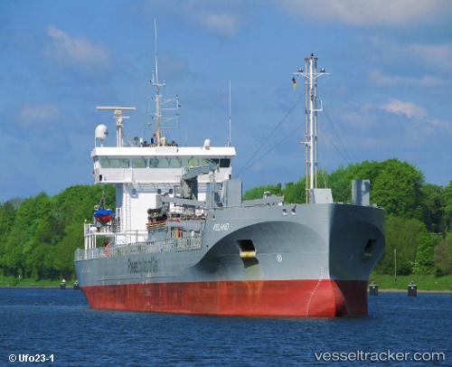
Vessel Ireland IMO: 9771456, MMSI: 244140388 Cement Carrier
UTC, 58.34500, 11.88167, course: -1, speed: 0
UTC, 58.34500, 11.88167, course: -1, speed: 0
2026-01-17 09:25:58 UTC, 58.34500, 11.88167, course: -1, speed: 0
Live AIS position:
UTC. Near Uddevalla),
updated 2026-01-17 09:25:58 UTC.
Find the position of the vessel Ireland on the map. The latter are known coordinates and path.
marine traffic ship tracker show on live map
The current position of vessel Ireland is 58.34500 lat / 11.88167 lng. Updated: 2026-01-17 09:25:58 UTCCurrently sailing under the flag of Netherlands
Details:
Last coordinates of the vessel:
UTC, 58.34500, 11.88167, course: -1, speed: 0UTC, 58.34500, 11.88167, course: -1, speed: 0
UTC, 58.34500, 11.88167, course: -1, speed: 0
2026-01-17 09:25:58 UTC, 58.34500, 11.88167, course: -1, speed: 0