 vesseltracker.com
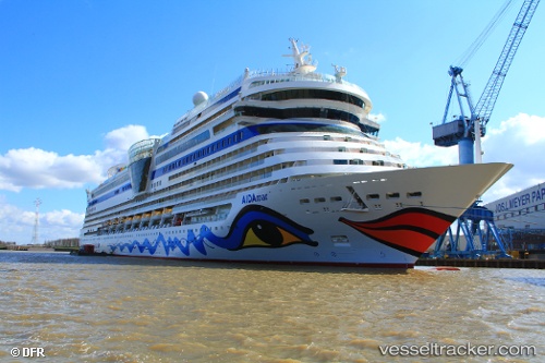
Vessel Aidamar IMO: 9490052, MMSI: 247312900 Cruise Ship
UTC, 50.89092, -1.39992, course: 11, speed: 1.9
UTC, 50.71742, -1.00767, course: 110, speed: 11.8
2026-01-13 22:02:21 UTC, 50.63153, -0.96712, course: 145, speed: 10.5
Live AIS position:
UTC. Near Bembridge),
updated 2026-01-13 22:02:21 UTC.
Find the position of the vessel Aidamar on the map. The latter are known coordinates and path.
marine traffic ship tracker show on live map
The current position of vessel Aidamar is 50.63153 lat / -0.96712 lng. Updated: 2026-01-13 22:02:21 UTCCurrently sailing under the flag of Italy
Aidamar built in 2012 year
Deadweight:
7757 tDetails:
Last coordinates of the vessel:
UTC, 50.89283, -1.39947, course: 13, speed: 0UTC, 50.89092, -1.39992, course: 11, speed: 1.9
UTC, 50.71742, -1.00767, course: 110, speed: 11.8
2026-01-13 22:02:21 UTC, 50.63153, -0.96712, course: 145, speed: 10.5