 vesseltracker.com
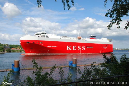
Find the position of the vessel Danube Highway on the map. The latter are known coordinates and path.
marine traffic ship tracker show on live map
The current position of vessel Danube Highway is 51.30903 lat / 3.22520 lng. Updated: 2025-09-27 02:56:02 UTCCurrently sailing under the flag of Bahamas
Danube Highway built in 2006 year
Deadweight:
7788 tDetails:
Last coordinates of the vessel:
UTC, 51.30903, 3.22520, course: 152, speed: 0UTC, 51.30904, 3.22521, course: 152, speed: 0
UTC, 51.30904, 3.22520, course: 152, speed: 0
2025-09-27 02:56:02 UTC, 51.30903, 3.22520, course: 152, speed: 0