 vesseltracker.com
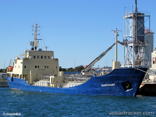
Vessel Eastcoast IMO: 5189136, MMSI: 249680000 General Cargo Ship
UTC, 43.18744, 16.29098, course: 198, speed: 9.1
UTC, 43.18744, 16.29098, course: 198, speed: 9.1
2026-01-18 12:34:27 UTC, 43.18744, 16.29098, course: 198, speed: 9.1
Live AIS position:
UTC. Near Drvenik),
updated 2026-01-18 12:34:27 UTC.
Find the position of the vessel Eastcoast on the map. The latter are known coordinates and path.
marine traffic ship tracker show on live map
The current position of vessel Eastcoast is 43.18744 lat / 16.29098 lng. Updated: 2026-01-18 12:34:27 UTCDetails:
Last coordinates of the vessel:
UTC, 43.18744, 16.29098, course: 198, speed: 9.1UTC, 43.18744, 16.29098, course: 198, speed: 9.1
UTC, 43.18744, 16.29098, course: 198, speed: 9.1
2026-01-18 12:34:27 UTC, 43.18744, 16.29098, course: 198, speed: 9.1