 vesseltracker.com
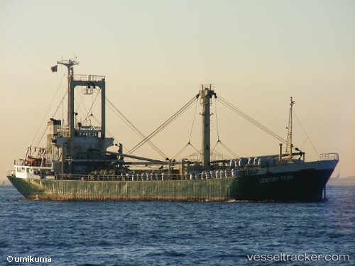
Vessel Rulas IMO: 8122311, MMSI: 677039100 General Cargo Ship
UTC, 38.68479, 26.50872, course: 100, speed: 7.7
UTC, 38.50828, 26.76771, course: 136, speed: 10.8
2026-01-17 10:00:40 UTC, 38.41729, 27.11027, course: 84, speed: 0.3
Live AIS position:
UTC. Near Konak),
updated 2026-01-17 10:00:40 UTC.
Find the position of the vessel Rulas on the map. The latter are known coordinates and path.
marine traffic ship tracker show on live map
The current position of vessel Rulas is 38.41729 lat / 27.11027 lng. Updated: 2026-01-17 10:00:40 UTCDetails:
Last coordinates of the vessel:
UTC, 38.52751, 26.31389, course: 356, speed: 9.5UTC, 38.68479, 26.50872, course: 100, speed: 7.7
UTC, 38.50828, 26.76771, course: 136, speed: 10.8
2026-01-17 10:00:40 UTC, 38.41729, 27.11027, course: 84, speed: 0.3