 vesseltracker.com
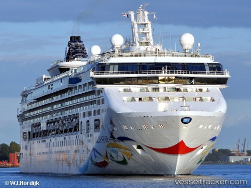
Vessel Norwegian Star IMO: 9195157, MMSI: 311082000 Cruise Ship
UTC, 23.16500, -85.48167, course: -1, speed: 14
UTC, 23.43833, -85.32667, course: -1, speed: 14
2026-01-18 12:08:43 UTC, 23.91333, -85.06833, course: -1, speed: 14
Live AIS position:
UTC. 95 nm NW of Santa Lucia),
updated 2026-01-18 12:08:43 UTC.
Find the position of the vessel Norwegian Star on the map. The latter are known coordinates and path.
marine traffic ship tracker show on live map
The current position of vessel Norwegian Star is 23.91333 lat / -85.06833 lng. Updated: 2026-01-18 12:08:43 UTCCurrently sailing under the flag of Bahamas
Norwegian Star built in 2001 year
Deadweight:
7500 tDetails:
Last coordinates of the vessel:
UTC, 22.90500, -85.62500, course: -1, speed: 15UTC, 23.16500, -85.48167, course: -1, speed: 14
UTC, 23.43833, -85.32667, course: -1, speed: 14
2026-01-18 12:08:43 UTC, 23.91333, -85.06833, course: -1, speed: 14