 vesseltracker.com
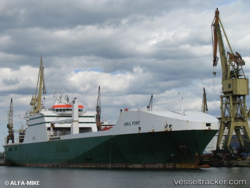
Vessel Anvil Point IMO: 9248540, MMSI: 235572000 Ro Ro Cargo Ship
UTC, 55.99409, 12.67359, course: 164, speed: 12.9
UTC, 55.73002, 12.86566, course: 147, speed: 13.1
2026-01-16 05:45:34 UTC, 55.19968, 13.41514, course: 103, speed: 13.2
Live AIS position:
UTC. 11 nm S of Klagstorp),
updated 2026-01-16 05:45:34 UTC.
Find the position of the vessel Anvil Point on the map. The latter are known coordinates and path.
marine traffic ship tracker show on live map
The current position of vessel Anvil Point is 55.19968 lat / 13.41514 lng. Updated: 2026-01-16 05:45:34 UTCCurrently sailing under the flag of United Kingdom
Anvil Point built in 2003 year
Deadweight:
13274 tDetails:
Last coordinates of the vessel:
UTC, 56.13099, 12.48380, course: 129, speed: 12.3UTC, 55.99409, 12.67359, course: 164, speed: 12.9
UTC, 55.73002, 12.86566, course: 147, speed: 13.1
2026-01-16 05:45:34 UTC, 55.19968, 13.41514, course: 103, speed: 13.2