 vesseltracker.com
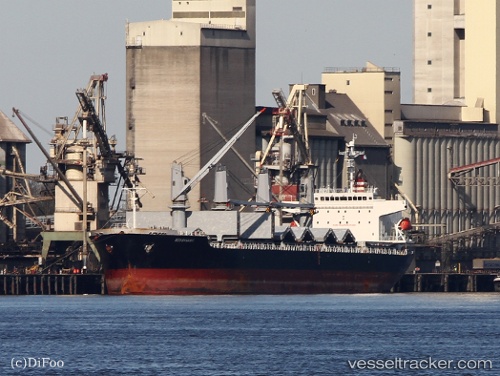
Vessel MADDOX IMO: 9277486, MMSI: 636021765 General Cargo Ship
UTC, 36.65239, -1.08627, course: 253, speed: 12.8
UTC, 36.61667, -1.23667, course: -1, speed: 12
2026-01-15 07:53:12 UTC, 36.54433, -1.63046, course: 253, speed: 13
Live AIS position:
UTC. 29 nm SE of CARBONERAS),
updated 2026-01-15 07:53:12 UTC.
Find the position of the vessel MADDOX on the map. The latter are known coordinates and path.
marine traffic ship tracker show on live map
The current position of vessel MADDOX is 36.54433 lat / -1.63046 lng. Updated: 2026-01-15 07:53:12 UTCCurrently sailing under the flag of Liberia
MADDOX built in 2005 year
Deadweight:
32354 tDetails:
Last coordinates of the vessel:
UTC, 36.72667, -0.73500, course: -1, speed: 13UTC, 36.65239, -1.08627, course: 253, speed: 12.8
UTC, 36.61667, -1.23667, course: -1, speed: 12
2026-01-15 07:53:12 UTC, 36.54433, -1.63046, course: 253, speed: 13