 vesseltracker.com
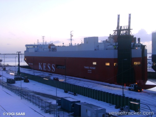
Vessel Thames Highway IMO: 9316294, MMSI: 311996000 Vehicles Carrier
UTC, 53.63621, 6.09918, course: 277, speed: 18.2
UTC, 53.71281, 5.75739, course: 253, speed: 17.6
2026-01-16 01:25:37 UTC, 53.61124, 5.15264, course: 250, speed: 15.9
Live AIS position:
UTC. 15 nm NW of Terschelling),
updated 2026-01-16 01:25:37 UTC.
Find the position of the vessel Thames Highway on the map. The latter are known coordinates and path.
marine traffic ship tracker show on live map
The current position of vessel Thames Highway is 53.61124 lat / 5.15264 lng. Updated: 2026-01-16 01:25:37 UTCCurrently sailing under the flag of Bahamas
Thames Highway built in 2005 year
Deadweight:
7750 tDetails:
Last coordinates of the vessel:
UTC, 53.49652, 6.81132, course: 318, speed: 18.1UTC, 53.63621, 6.09918, course: 277, speed: 18.2
UTC, 53.71281, 5.75739, course: 253, speed: 17.6
2026-01-16 01:25:37 UTC, 53.61124, 5.15264, course: 250, speed: 15.9