 vesseltracker.com
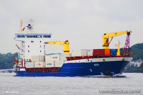
Vessel ORITA IMO: 9318931, MMSI: 373184000 Container Ship
UTC, 36.02506, 27.97055, course: 135, speed: 9.5
UTC, 36.02506, 27.97055, course: 135, speed: 9.5
2026-01-13 08:13:39 UTC, 36.02506, 27.97055, course: 135, speed: 9.5
Live AIS position:
UTC. Near Lardos Rhodes),
updated 2026-01-13 08:13:39 UTC.
Find the position of the vessel ORITA on the map. The latter are known coordinates and path.
marine traffic ship tracker show on live map
The current position of vessel ORITA is 36.02506 lat / 27.97055 lng. Updated: 2026-01-13 08:13:39 UTCCurrently sailing under the flag of Panama
ORITA built in 2005 year
Deadweight:
7993 tDetails:
Last coordinates of the vessel:
UTC, 36.02506, 27.97055, course: 135, speed: 9.5UTC, 36.02506, 27.97055, course: 135, speed: 9.5
UTC, 36.02506, 27.97055, course: 135, speed: 9.5
2026-01-13 08:13:39 UTC, 36.02506, 27.97055, course: 135, speed: 9.5