 vesseltracker.com
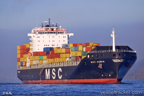
Vessel Msc Nuria IMO: 9349825, MMSI: 370273000 Container Ship
UTC, 37.06260, -75.40888, course: 222, speed: 8.9
UTC, 36.94258, -75.54114, course: 221, speed: 9.1
2026-01-18 18:30:43 UTC, 36.85566, -75.82043, course: 303, speed: 8.6
Live AIS position:
UTC. 10 nm E of Cape Henry),
updated 2026-01-18 18:30:43 UTC.
Find the position of the vessel Msc Nuria on the map. The latter are known coordinates and path.
marine traffic ship tracker show on live map
The current position of vessel Msc Nuria is 36.85566 lat / -75.82043 lng. Updated: 2026-01-18 18:30:43 UTCCurrently sailing under the flag of Panama
Msc Nuria built in 2008 year
Deadweight:
63377 tDetails:
Last coordinates of the vessel:
UTC, 37.09782, -75.37248, course: 219, speed: 9.1UTC, 37.06260, -75.40888, course: 222, speed: 8.9
UTC, 36.94258, -75.54114, course: 221, speed: 9.1
2026-01-18 18:30:43 UTC, 36.85566, -75.82043, course: 303, speed: 8.6