 vesseltracker.com
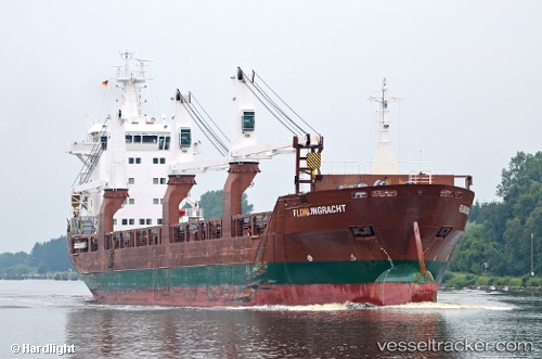
Find the position of the vessel Florijngracht on the map. The latter are known coordinates and path.
marine traffic ship tracker show on live map
The current position of vessel Florijngracht is 11.1997 lat / 99.5798 lng. Updated: 2025-07-04 03:28:07 UTCCurrently sailing under the flag of Netherlands
Florijngracht built in 2010 year
Port of registry:
Amsterdam (capital and most populous city of the Netherlands)Speed:
14 knotDeadweight:
12500 tPayload_mass:
12500 tonneGross tonnage:
8620Service entry:
2010-01-01T00:00:00ZDetails:
Last coordinates of the vessel:
UTC, 11.1997, 99.5798, course: 182, speed: 0UTC, 11.1997, 99.5798, course: 182, speed: 0
UTC, 11.1997, 99.5798, course: 182, speed: 0
2025-07-04 03:28:07 UTC, 11.1997, 99.5798, course: 182, speed: 0