 vesseltracker.com
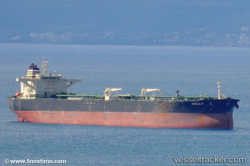
Vessel Mikela P. IMO: 9440382, MMSI: 538008330 Crude Oil Tanker
UTC, -33.75500, 17.87333, course: -1, speed: 12
UTC, -33.54657, 17.31387, course: 282, speed: 14.6
2026-01-16 13:25:46 UTC, -33.47508, 17.03853, course: 283, speed: 14.6
Live AIS position:
UTC. 48 nm SW of Saldanha Bay),
updated 2026-01-16 13:25:46 UTC.
Find the position of the vessel Mikela P. on the map. The latter are known coordinates and path.
marine traffic ship tracker show on live map
The current position of vessel Mikela P. is -33.47508 lat / 17.03853 lng. Updated: 2026-01-16 13:25:46 UTCCurrently sailing under the flag of Marshall Is
Mikela P. built in 2009 year
Deadweight:
158007 tDetails:
Last coordinates of the vessel:
UTC, -33.79365, 18.05940, course: 283, speed: 12.3UTC, -33.75500, 17.87333, course: -1, speed: 12
UTC, -33.54657, 17.31387, course: 282, speed: 14.6
2026-01-16 13:25:46 UTC, -33.47508, 17.03853, course: 283, speed: 14.6