 vesseltracker.com
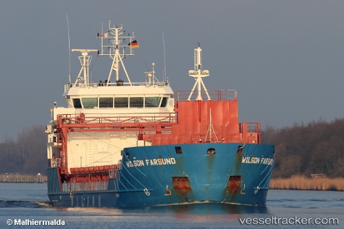
Vessel Wilson Farsund IMO: 9491733, MMSI: 314377000 Multi Purpose Carrier
UTC, 56.41978, 10.93087, course: 24, speed: 0
UTC, 56.41973, 10.93106, course: 24, speed: 0
2026-01-17 16:53:31 UTC, 56.41969, 10.93099, course: 24, speed: 0
Live AIS position:
UTC. Near GRENAA),
updated 2026-01-17 16:53:31 UTC.
Find the position of the vessel Wilson Farsund on the map. The latter are known coordinates and path.
marine traffic ship tracker show on live map
The current position of vessel Wilson Farsund is 56.41969 lat / 10.93099 lng. Updated: 2026-01-17 16:53:31 UTCCurrently sailing under the flag of Barbados
Wilson Farsund built in 2012 year
Deadweight:
4340 tDetails:
Last coordinates of the vessel:
UTC, 56.41978, 10.93087, course: 24, speed: 0UTC, 56.41978, 10.93087, course: 24, speed: 0
UTC, 56.41973, 10.93106, course: 24, speed: 0
2026-01-17 16:53:31 UTC, 56.41969, 10.93099, course: 24, speed: 0