 vesseltracker.com
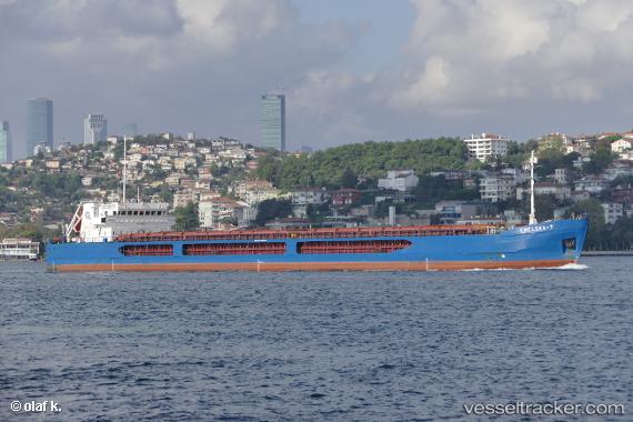
Vessel Chelsea 7 IMO: 9492634, MMSI: 215991000 General Cargo Ship
UTC, 34.6422, 32.4602, course: 293, speed: 8.5
UTC, 34.7067, 32.2967, course: -1, speed: 8
2026-01-18 18:19:02 UTC, 34.8867, 31.9517, course: -1, speed: 7
Live AIS position:
UTC. 24 nm W of Paphos),
updated 2026-01-18 18:19:02 UTC.
Find the position of the vessel Chelsea 7 on the map. The latter are known coordinates and path.
marine traffic ship tracker show on live map
The current position of vessel Chelsea 7 is 34.8867 lat / 31.9517 lng. Updated: 2026-01-18 18:19:02 UTCCurrently sailing under the flag of Malta
Chelsea 7 built in 2010 year
Deadweight:
6320 tDetails:
Last coordinates of the vessel:
UTC, 34.5905, 32.5865, course: 293, speed: 7.7UTC, 34.6422, 32.4602, course: 293, speed: 8.5
UTC, 34.7067, 32.2967, course: -1, speed: 8
2026-01-18 18:19:02 UTC, 34.8867, 31.9517, course: -1, speed: 7