 vesseltracker.com
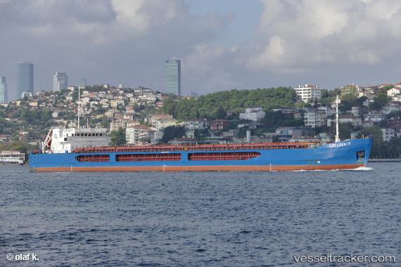
Find the position of the vessel Chelsea 7 on the map. The latter are known coordinates and path.
marine traffic ship tracker show on live map
The current position of vessel Chelsea 7 is 38.7665 lat / 26.8939 lng. Updated: 2025-10-11 02:32:47 UTCCurrently sailing under the flag of Malta
Chelsea 7 built in 2010 year
Deadweight:
6320 tDetails:
Last coordinates of the vessel:
UTC, 38.7658, 26.8926, course: 4, speed: 0UTC, 38.7669, 26.8942, course: 274, speed: 0
UTC, 38.767, 26.8941, course: 268, speed: 0
2025-10-11 02:32:47 UTC, 38.7665, 26.8939, course: 300, speed: 0
The ship also appears on the maps: