 vesseltracker.com
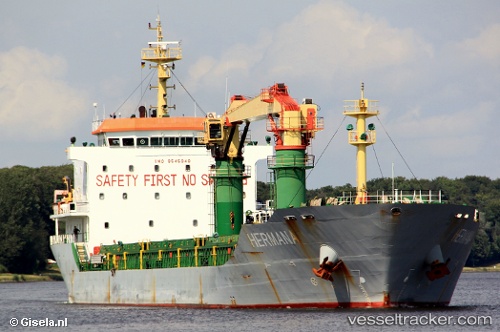
Vessel Hermana IMO: 9545948, MMSI: 247293700 General Cargo Ship
UTC, 31.32217, 30.07577, course: 265, speed: 0
UTC, 31.32167, 30.07500, course: -1, speed: 0
2026-01-17 17:23:47 UTC, 31.32214, 30.07573, course: 265, speed: 0
Live AIS position:
UTC. Near ABU QIR),
updated 2026-01-17 17:23:47 UTC.
Find the position of the vessel Hermana on the map. The latter are known coordinates and path.
marine traffic ship tracker show on live map
The current position of vessel Hermana is 31.32214 lat / 30.07573 lng. Updated: 2026-01-17 17:23:47 UTCCurrently sailing under the flag of Italy
Hermana built in 2010 year
Deadweight:
11500 tDetails:
Last coordinates of the vessel:
UTC, 31.32224, 30.07575, course: 265, speed: 0UTC, 31.32217, 30.07577, course: 265, speed: 0
UTC, 31.32167, 30.07500, course: -1, speed: 0
2026-01-17 17:23:47 UTC, 31.32214, 30.07573, course: 265, speed: 0