 vesseltracker.com
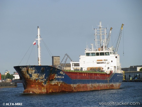
Vessel MEMNUNE K IMO: 9576703, MMSI: 314663000 General Cargo Ship
UTC, 36.92230, 2.32357, course: 253, speed: 7.1
UTC, 36.92230, 2.32357, course: 253, speed: 7.1
2026-01-19 00:07:27 UTC, 36.85292, 2.06650, course: 257, speed: 7.4
Live AIS position:
UTC. 16 nm NW of Cherchell),
updated 2026-01-19 00:07:27 UTC.
Find the position of the vessel MEMNUNE K on the map. The latter are known coordinates and path.
marine traffic ship tracker show on live map
The current position of vessel MEMNUNE K is 36.85292 lat / 2.06650 lng. Updated: 2026-01-19 00:07:27 UTCCurrently sailing under the flag of Barbados
MEMNUNE K built in 2010 year
Deadweight:
4487 tDetails:
Last coordinates of the vessel:
UTC, 36.98625, 2.48501, course: 251, speed: 7.2UTC, 36.92230, 2.32357, course: 253, speed: 7.1
UTC, 36.92230, 2.32357, course: 253, speed: 7.1
2026-01-19 00:07:27 UTC, 36.85292, 2.06650, course: 257, speed: 7.4