 vesseltracker.com
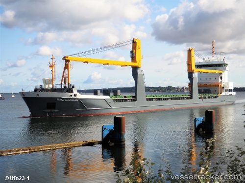
Vessel Trent Navigator IMO: 9631369, MMSI: 246867000 General Cargo Ship
UTC, 50.00863, -2.88570, course: 256, speed: 12.9
UTC, 49.91722, -3.16543, course: 239, speed: 11.7
2026-01-17 15:28:57 UTC, 49.83878, -3.36602, course: 239, speed: 11.2
Live AIS position:
UTC. 28 nm SE of Bolt Head),
updated 2026-01-17 15:28:57 UTC.
Find the position of the vessel Trent Navigator on the map. The latter are known coordinates and path.
marine traffic ship tracker show on live map
The current position of vessel Trent Navigator is 49.83878 lat / -3.36602 lng. Updated: 2026-01-17 15:28:57 UTCCurrently sailing under the flag of Netherlands
Trent Navigator built in 2013 year
Deadweight:
8096 tDetails:
Last coordinates of the vessel:
UTC, 50.05548, -2.59670, course: 257, speed: 14.1UTC, 50.00863, -2.88570, course: 256, speed: 12.9
UTC, 49.91722, -3.16543, course: 239, speed: 11.7
2026-01-17 15:28:57 UTC, 49.83878, -3.36602, course: 239, speed: 11.2