 vesseltracker.com
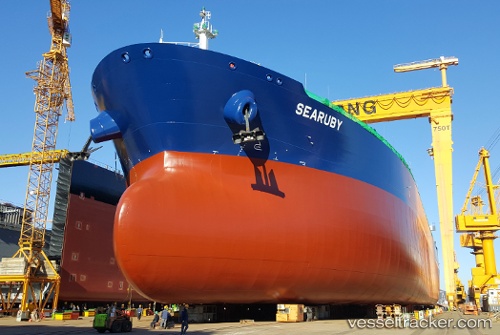
Vessel Searuby IMO: 9759795, MMSI: 249693000 Crude Oil Tanker
UTC, 25.11167, -90.90667, course: -1, speed: 12
UTC, 25.25822, -91.43500, course: 295, speed: 12.4
2026-01-17 21:13:51 UTC, 25.31833, -91.65333, course: -1, speed: 12
Live AIS position:
UTC. 123 nm NW of Munshiganj),
updated 2026-01-17 21:13:51 UTC.
Find the position of the vessel Searuby on the map. The latter are known coordinates and path.
marine traffic ship tracker show on live map
The current position of vessel Searuby is 25.31833 lat / -91.65333 lng. Updated: 2026-01-17 21:13:51 UTCDetails:
Last coordinates of the vessel:
UTC, 25.06833, -90.72833, course: -1, speed: 12UTC, 25.11167, -90.90667, course: -1, speed: 12
UTC, 25.25822, -91.43500, course: 295, speed: 12.4
2026-01-17 21:13:51 UTC, 25.31833, -91.65333, course: -1, speed: 12