 vesseltracker.com
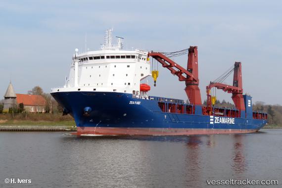
Vessel Zea Fast IMO: 9785392, MMSI: 255806186 Heavy Load Carrier
UTC, 56.24890, 7.07000, course: 209, speed: 10.8
UTC, 56.23967, 7.05857, course: 210, speed: 10.9
2026-01-15 09:50:24 UTC, 56.00966, 6.77445, course: 212, speed: 12.4
Live AIS position:
UTC. 45 nm W of HVIDE SANDE),
updated 2026-01-15 09:50:24 UTC.
Find the position of the vessel Zea Fast on the map. The latter are known coordinates and path.
marine traffic ship tracker show on live map
The current position of vessel Zea Fast is 56.00966 lat / 6.77445 lng. Updated: 2026-01-15 09:50:24 UTCCurrently sailing under the flag of Portugal
Details:
Last coordinates of the vessel:
UTC, 56.62465, 7.54164, course: 210, speed: 12UTC, 56.24890, 7.07000, course: 209, speed: 10.8
UTC, 56.23967, 7.05857, course: 210, speed: 10.9
2026-01-15 09:50:24 UTC, 56.00966, 6.77445, course: 212, speed: 12.4