 vesseltracker.com
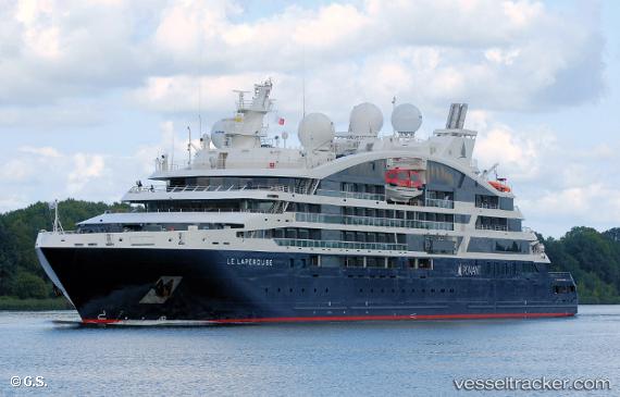
Vessel Le Laperouse IMO: 9814026, MMSI: 578000900 Cruise Ship
UTC, 11.70333, -16.51667, course: -1, speed: 12
UTC, 11.66866, -16.32590, course: 93, speed: 11.9
2026-01-17 13:38:22 UTC, 11.68333, -16.15500, course: -1, speed: 13
Live AIS position:
UTC. 31 nm NW of Bubaque),
updated 2026-01-17 13:38:22 UTC.
Find the position of the vessel Le Laperouse on the map. The latter are known coordinates and path.
marine traffic ship tracker show on live map
The current position of vessel Le Laperouse is 11.68333 lat / -16.15500 lng. Updated: 2026-01-17 13:38:22 UTCCurrently sailing under the flag of Wallis Futuna Is
Details:
Last coordinates of the vessel:
UTC, 11.71602, -16.82322, course: 87, speed: 12.3UTC, 11.70333, -16.51667, course: -1, speed: 12
UTC, 11.66866, -16.32590, course: 93, speed: 11.9
2026-01-17 13:38:22 UTC, 11.68333, -16.15500, course: -1, speed: 13