 Alfred
Current Status
Where is the vessel?
Alfred is currently in Near BRODICK, based on AIS data received about 14h ago.
Latest AIS update:
Current position: 55.57790° N, 5.13588° W (Near BRODICK)
Average speed (last 7 days): Loading…
Average speed (last 30 days): Loading…
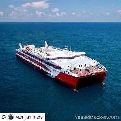
Vessel profile: Alfred is a Passenger Ship with dimensions 85m x 22m.
This page combines live AIS, route history, probable destination signals, nearby traffic, and port activity for practical vessel monitoring.
The current position of vessel Alfred is 55.57790 lat / -5.13588 lng. Updated: 2026-07-27 21:45:11 UTCNearest reference points:
- Near BRODICK
- Near Shiskine
- Near Lamlash
Currently sailing under the flag of United Kingdom ![]()
Details:
Live Vessel Alfred Analytics (details, animations, etc.)
Recent AIS points (UTC):
2026-07-27 17:38:35 UTC · 55.56512, -4.86277 · SOG 13.8 kn · COG 269°2026-07-27 19:12:12 UTC · 55.57794, -5.13583 · SOG 0 kn · COG 23°
2026-07-27 19:24:08 UTC · 55.57794, -5.13584 · SOG 0 kn · COG 23°
2026-07-27 21:45:11 UTC · 55.57790, -5.13588 · SOG 0 kn · COG 23°