 vesseltracker.com
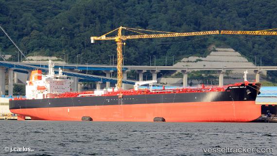
Vessel Elandra Maple IMO: 9831191, MMSI: 636018543 Oil Products Tanker
UTC, -33.82193, 18.41959, course: 218, speed: 0.1
UTC, -33.82133, 18.41862, course: 197, speed: 0.6
2026-01-18 14:12:13 UTC, -33.82115, 18.41804, course: 180, speed: 0.3
Live AIS position:
UTC. Near ROBBEN ISLAND),
updated 2026-01-18 14:12:13 UTC.
Find the position of the vessel Elandra Maple on the map. The latter are known coordinates and path.
marine traffic ship tracker show on live map
The current position of vessel Elandra Maple is -33.82115 lat / 18.41804 lng. Updated: 2026-01-18 14:12:13 UTCDetails:
Last coordinates of the vessel:
UTC, -33.82182, 18.41946, course: 220, speed: 0.1UTC, -33.82193, 18.41959, course: 218, speed: 0.1
UTC, -33.82133, 18.41862, course: 197, speed: 0.6
2026-01-18 14:12:13 UTC, -33.82115, 18.41804, course: 180, speed: 0.3