 vesseltracker.com
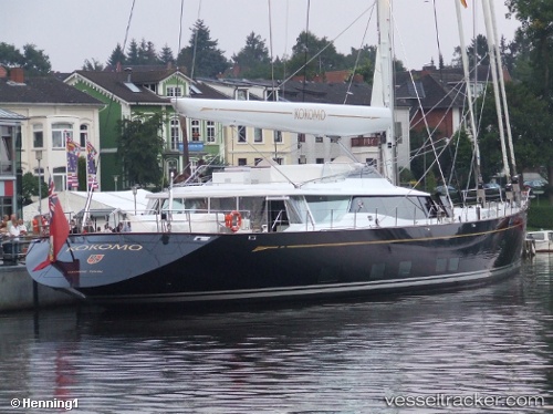
Vessel Sy Kokomo IMO: 1010480, MMSI: 319016700 Service Ship
UTC, -8.37667, -87.85167, course: -1, speed: 12
UTC, -7.98136, -87.90403, course: 353, speed: 11.1
2026-01-31 02:12:08 UTC, -7.58792, -87.94370, course: 356, speed: 11.1
Live AIS position:
UTC. 387 nm S of Espanola Island),
updated 2026-01-31 02:12:08 UTC.
Find the position of the vessel Sy Kokomo on the map. The latter are known coordinates and path.
marine traffic ship tracker show on live map
The current position of vessel Sy Kokomo is -7.58792 lat / -87.94370 lng. Updated: 2026-01-31 02:12:08 UTCCurrently sailing under the flag of Cayman Is
Sy Kokomo built in 2010 year
Deadweight:
95 tDetails:
Last coordinates of the vessel:
UTC, -8.78212, -87.86358, course: 11, speed: 11.4UTC, -8.37667, -87.85167, course: -1, speed: 12
UTC, -7.98136, -87.90403, course: 353, speed: 11.1
2026-01-31 02:12:08 UTC, -7.58792, -87.94370, course: 356, speed: 11.1