 vesseltracker.com
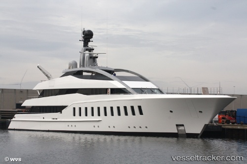
Vessel Halo IMO: 1012775, MMSI: 319086500 Sailing Vessel
UTC, 9.36567, -79.94176, course: 51, speed: 1
UTC, 9.36568, -79.94155, course: 338, speed: 0.8
2026-02-01 10:20:52 UTC, 9.36568, -79.94120, course: 314, speed: 0.7
Live AIS position:
UTC. Near Fort Sherman),
updated 2026-02-01 10:20:52 UTC.
Find the position of the vessel Halo on the map. The latter are known coordinates and path.
marine traffic ship tracker show on live map
The current position of vessel Halo is 9.36568 lat / -79.94120 lng. Updated: 2026-02-01 10:20:52 UTCDetails:
Last coordinates of the vessel:
UTC, 9.44552, -79.92406, course: 145, speed: 12.6UTC, 9.36567, -79.94176, course: 51, speed: 1
UTC, 9.36568, -79.94155, course: 338, speed: 0.8
2026-02-01 10:20:52 UTC, 9.36568, -79.94120, course: 314, speed: 0.7