 vesseltracker.com
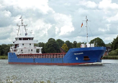
Vessel NAOMI B IMO: 9557367, MMSI: 210383000 General Cargo Ship
UTC, 38.29921, 0.12346, course: 31, speed: 7.7
UTC, 38.44798, 0.25637, course: 34, speed: 8.2
2026-02-14 06:24:47 UTC, 38.70183, 0.48502, course: 117, speed: 7.2
Live AIS position:
UTC. Near Ventas de Pedreguer),
updated 2026-02-14 06:24:47 UTC.
Find the position of the vessel NAOMI B on the map. The latter are known coordinates and path.
marine traffic ship tracker show on live map
The current position of vessel NAOMI B is 38.70183 lat / 0.48502 lng. Updated: 2026-02-14 06:24:47 UTCCurrently sailing under the flag of Cyprus
NAOMI B built in 2013 year
Deadweight:
2589 tDetails:
Last coordinates of the vessel:
UTC, 38.25666, 0.09184, course: 29, speed: 7.5UTC, 38.29921, 0.12346, course: 31, speed: 7.7
UTC, 38.44798, 0.25637, course: 34, speed: 8.2
2026-02-14 06:24:47 UTC, 38.70183, 0.48502, course: 117, speed: 7.2